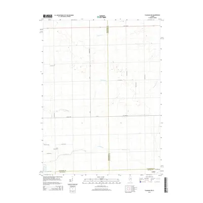
2015 Map of Flanagan SW
USGS Topo · Published 2015About this map
Gridley sits at the southern edge of this Central Illinois landscape, where the borders of McLean, Livingston, and Woodford counties meet. The area is defined by a traditional grid of agricultural roads, including Co Road 1400 N and Co Road 3100 E, which navigate a terrain carved by several waterways. Small tributaries like Short Point Cr and Little Panther Cr meander across the plains, reflecting the rural character of the region.
Find a feature on this map
27 named features on this map. Tap any name to fly to it.
Don’t see what you’re looking for? This feature index may not catch every label — zoom into the map to look around manually.
Map Details
Editions of this 2015 Flanagan SW Map
This is the sole edition of this map. No revisions or reprints were ever made.
Other maps of this area

1926 · Normal
USGS Topo · 1:62,500

1927 · Danvers
USGS Topo · 1:62,500

1930 · Danvers
USGS Topo · 1:62,500

1930 · Normal
USGS Topo · 1:62,500

1955 · Minonk
USGS Topo · 1:62,500

1958 · Flanagan
USGS Topo · 1:62,500

1958 · Peoria
USGS Topo · 1:250,000

1961 · Peoria
USGS Topo · 1:250,000

1963 · Peoria
USGS Topo · 1:250,000
1970 · El Paso
USGS Topo · 1:24,000