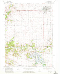
1970 Map of El Paso
USGS Topo · Published 1972About this map
The city of El Paso serves as a primary hub in this central Illinois landscape, situated at the intersection of significant rail and road corridors. The Toledo Peoria and Western railroad cuts across the northern landscape, while the village of Kappa sits further south along the Illinois Central line. A notable transformation is underway in the southern portion of the map, where Evergreen Lake is shown near Sixmile Creek, with areas marked as being under construction. This suggests a shift toward recreational or water-management infrastructure during the late 1960s.
Find a feature on this map
24 named features on this map. Tap any name to fly to it.
Don’t see what you’re looking for? This feature index may not catch every label — zoom into the map to look around manually.
Map Details
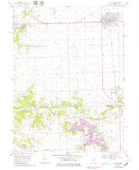
Editions of this 1970 El Paso Map
2 editions found
Other maps of this area

1926 · Normal
USGS Topo · 1:62,500

1927 · Danvers
USGS Topo · 1:62,500

1930 · Danvers
USGS Topo · 1:62,500

1930 · Normal
USGS Topo · 1:62,500

1955 · Minonk
USGS Topo · 1:62,500

1958 · Flanagan
USGS Topo · 1:62,500

1958 · Peoria
USGS Topo · 1:250,000

1961 · Peoria
USGS Topo · 1:250,000

1963 · Peoria
USGS Topo · 1:250,000
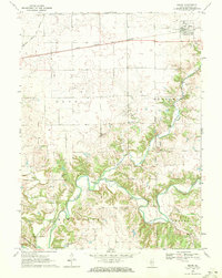
1970 · Secor
USGS Topo · 1:24,000