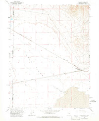
1964 Map of Flanigan
USGS Topo · Published 1966About this map
Flanigan sits at a critical junction of the high desert rail corridor in the mid-1960s, where the Southern Pacific and Western Pacific lines converge. This arid landscape on the California Nevada border is defined by its reliance on isolated water sources like Flanigan Well and High Rock Well to sustain life and industry. The presence of the Bonham Sch near the tracks suggests a small, localized community supporting the railroad operations and nearby ranching interests. To the west, the expansive bed of Honey Lake dominates the terrain, illustrating the dramatic seasonal geography of the region. The map also traces the Lassen Co Washoe Co boundary, marking the transition between the two states through a network of Jeep Trails and remote outposts.
Find a feature on this map
12 named features on this map. Tap any name to fly to it.
Don’t see what you’re looking for? This feature index may not catch every label — zoom into the map to look around manually.
Map Details
Editions of this 1964 Flanigan Map
4 editions found
Other maps of this area

1886 · Honey Lake
USGS Topo · 1:250,000

1886 · Granite Range
USGS Topo · 1:250,000

1891 · Honey Lake
USGS Topo · 1:250,000

1893 · Honey Lake
USGS Topo · 1:250,000

1894 · Granite Range
USGS Topo · 1:250,000

1954 · Wendel
USGS Topo · 1:62,500

1954 · Doyle
USGS Topo · 1:62,500

1955 · Westwood
USGS Topo · 1:250,000

1955 · Lovelock
USGS Topo · 1:250,000

1958 · Westwood
USGS Topo · 1:250,000