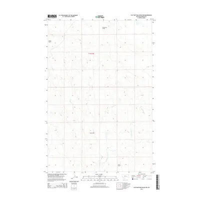
2014 Map of Flat Bottom Coulee SW
USGS Topo · Published 2014About this map
Flat Bottom Coulee characterizes this section of Rosebud County, where the high plains are carved by a network of drainage channels. The landscape is defined by the headwaters and intermittent flows of Longfork Cr and its tributary, the E Fork Longfork Cr. This map documents the complex topography of the Montana rangelands, highlighting several prominent natural features such as Nelson Coulee in the northwest and Larson Coulee to the south. The public land survey system grid, including townships t10n r38e and t9n r38e, provides a framework for understanding the historic division of this territory. The arrangement of these coulees suggests a landscape shaped by seasonal runoff, essential for the livestock and ranching activities that have historically sustained this region.
Find a feature on this map
7 named features on this map. Tap any name to fly to it.
Don’t see what you’re looking for? This feature index may not catch every label — zoom into the map to look around manually.
Map Details
Editions of this 2014 Flat Bottom Coulee SW Map
This is the sole edition of this map. No revisions or reprints were ever made.
Other maps of this area

1954 · Forsyth
USGS Topo · 1:250,000

1957 · Forsyth
USGS Topo · 1:250,000

1958 · Forsyth
USGS Topo · 1:250,000

1960 · Vananda
USGS Topo · 1:24,000

1960 · Brown Coulee
USGS Topo · 1:24,000

1960 · Zempel Lake
USGS Topo · 1:24,000

1968 · Donleys Reservoir
USGS Topo · 1:24,000

1968 · Finch NE
USGS Topo · 1:24,000

1969 · Flat Bottom Coulee SW
USGS Topo · 1:24,000

1969 · Flat Bottom Coulee NE
USGS Topo · 1:24,000