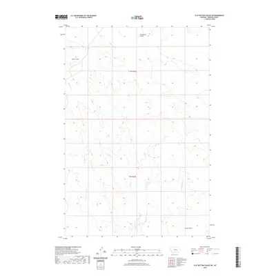
2020 Map of Flat Bottom Coulee SW
USGS Topo · Published 2020About this map
Longfork Cr and its tributary, the E Fork Longfork Cr, wind through this section of Rosebud County, Montana, defining a landscape shaped by persistent water action in an arid environment. The terrain is characterized by deeply incised drainage features, including Nelson Coulee in the northwest and Larson Coulee to the southeast. The namesake Flat Bottom Coulee dominates the northern reaches, illustrating the typical broad-floored erosion patterns found in this part of the northern plains. This 2020 edition documents the area within townships t10n r38e and t9n r38e, showing a region largely devoid of dense settlement, where the topographical labels serve as the primary markers for navigation and land management.
Find a feature on this map
7 named features on this map. Tap any name to fly to it.
Don’t see what you’re looking for? This feature index may not catch every label — zoom into the map to look around manually.
Map Details
Editions of this 2020 Flat Bottom Coulee SW Map
This is the sole edition of this map. No revisions or reprints were ever made.
Other maps of this area

1954 · Forsyth
USGS Topo · 1:250,000

1957 · Forsyth
USGS Topo · 1:250,000

1958 · Forsyth
USGS Topo · 1:250,000

1960 · Vananda
USGS Topo · 1:24,000

1960 · Brown Coulee
USGS Topo · 1:24,000

1960 · Zempel Lake
USGS Topo · 1:24,000

1968 · Donleys Reservoir
USGS Topo · 1:24,000

1968 · Finch NE
USGS Topo · 1:24,000

1969 · Flat Bottom Coulee SW
USGS Topo · 1:24,000

1969 · Flat Bottom Coulee NE
USGS Topo · 1:24,000