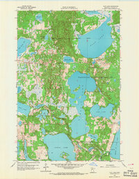
1959 Map of Flat Lake
USGS Topo · Published 1967About this map
Tamarac National Wildlife Refuge dominates this lake-strewn landscape in Becker County, where glacial depressions have created a dense network of marshes and water bodies. The White Earth Indian Reservation Boundary cuts across the northern half of the sheet, delineating historical land divisions near Sugar Bush. This 1959 field check reveals a quiet, rural interior defined by isolated landmarks such as Egelund Ch and a Town Hall in Holmesville.
Find a feature on this map
34 named features on this map. Tap any name to fly to it.
Don’t see what you’re looking for? This feature index may not catch every label — zoom into the map to look around manually.
Map Details
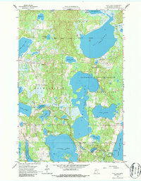
Editions of this 1959 Flat Lake Map
3 editions found
Other maps of this area

1953 · Brainerd
USGS Topo · 1:250,000

1954 · Bemidji
USGS Topo · 1:250,000

1957 · Brainerd
USGS Topo · 1:250,000

1957 · Bemidji
USGS Topo · 1:250,000

1958 · Bemidji
USGS Topo · 1:250,000

1958 · Brainerd
USGS Topo · 1:250,000

1959 · Toad Mountain
USGS Topo · 1:24,000

1959 · Flat Lake
USGS Topo · 1:24,000

1959 · Rochert
USGS Topo · 1:24,000

1959 · Richwood
USGS Topo · 1:24,000