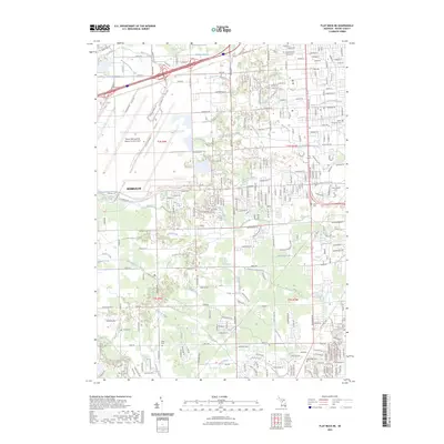
2023 Map of Flat Rock NE
USGS Topo · Published 2023About this map
The Detroit Metropolitan Wayne County Airport dominates the northwestern portion of this landscape, its massive infrastructure contrastingly surrounded by a complex network of historical drainage channels like the Sloss and Ginong Drain and Sexton and Kilfoil Drain. This 2023 survey of the Romulus area reveals a suburban and industrial fabric woven through with significant genealogical markers, including numerous local burial grounds such as Taylor Township Cem and West Mound Cem. The southern reach is defined by the winding course of the Huron River, accompanied by the Huron River Water Trail Upper River. The dense naming of small waterways like Hale Creek and Blakely Drain reflects the historical effort to manage the low-lying terrain of Wayne County for settlement and transit along major corridors like I-94.
Find a feature on this map
48 named features on this map. Tap any name to fly to it.
Don’t see what you’re looking for? This feature index may not catch every label — zoom into the map to look around manually.
Map Details
Editions of this 2023 Flat Rock NE Map
This is the sole edition of this map. No revisions or reprints were ever made.
Other maps of this area

1905 · Wayne
USGS Topo · 1:62,500

1905 · Detroit
USGS Topo · 1:62,500

1906 · Wyandotte
USGS Topo · 1:62,500

1906 · Romulus
USGS Topo · 1:62,500

1912 · Wyandotte
USGS Topo · 1:62,500

1912 · Wayne
USGS Topo · 1:62,500

1918 · Detroit
USGS Topo · 1:62,500

1924 · Detroit
USGS Topo · 1:62,500

1928 · Romulus
USGS Topo · 1:62,500

1929 · Wyandotte
USGS Topo · 1:62,500