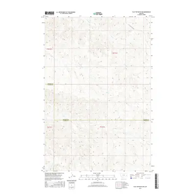
2017 Map of Flat Top Butte SW
USGS Topo · Published 2017About this map
Tenmile Cr and its various tributaries define the drainage patterns across this section of the eastern Montana plains during the late twenty-first century. The landscape is marked by the irregular boundary between Prairie Co and Custer Co, highlighting the administrative divisions within this sparsely populated ranching region. While largely open terrain, the area is connected by Little Whitney Creek Rd in the northeastern corner, providing access to the higher ground near the county line. The map detail shows several small seasonal watercourses, including Flat Cr, Coal Cr, and Sheep Cr, which carve subtle paths through the township and range grid system of T10N and T9N. This 2017 survey reflects the enduring character of the Big Sky country, where geography is primarily defined by water access and section lines.
Find a feature on this map
10 named features on this map. Tap any name to fly to it.
Don’t see what you’re looking for? This feature index may not catch every label — zoom into the map to look around manually.
Map Details
Editions of this 2017 Flat Top Butte SW Map
This is the sole edition of this map. No revisions or reprints were ever made.
Other maps of this area

1953 · Miles City
USGS Topo · 1:250,000

1957 · Miles City
USGS Topo · 1:250,000

1958 · Miles City
USGS Topo · 1:250,000

1969 · Little Whitney Creek
USGS Topo · 1:24,000

1969 · Spring Draw
USGS Topo · 1:24,000

1969 · Zero NE
USGS Topo · 1:24,000

1969 · Hogan Creek
USGS Topo · 1:24,000

1969 · Montague Butte
USGS Topo · 1:24,000

1969 · Flat Top Butte SW
USGS Topo · 1:24,000

1969 · Flat Top Butte
USGS Topo · 1:24,000