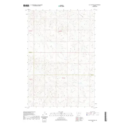
2020 Map of Flat Top Butte SW
USGS Topo · Published 2020About this map
Tenmile Creek flows through the high plains of Eastern Montana in this 2020 topographic map, defining a landscape of rolling drainage systems along the Prairie County and Custer County line. This rural corridor is characterized by its seasonal waterways, including the winding paths of Flat Creek and Coal Creek, which carve out the distinct topography of the Flat Top Butte SW quadrangle. The area's infrastructure is sparse, focused on the transition between Township 10 North and Township 9 North, with Little Whitney Creek Rd providing one of the few named access routes through this cattle-country terrain. Researchers can trace the hydrography of Deep Creek and the surrounding draws, which speak to the historic ranching and grazing patterns that have long defined this portion of the northern Great Plains.
Find a feature on this map
10 named features on this map. Tap any name to fly to it.
Don’t see what you’re looking for? This feature index may not catch every label — zoom into the map to look around manually.
Map Details
Editions of this 2020 Flat Top Butte SW Map
This is the sole edition of this map. No revisions or reprints were ever made.
Other maps of this area

1953 · Miles City
USGS Topo · 1:250,000

1957 · Miles City
USGS Topo · 1:250,000

1958 · Miles City
USGS Topo · 1:250,000

1969 · Little Whitney Creek
USGS Topo · 1:24,000

1969 · Spring Draw
USGS Topo · 1:24,000

1969 · Zero NE
USGS Topo · 1:24,000

1969 · Hogan Creek
USGS Topo · 1:24,000

1969 · Montague Butte
USGS Topo · 1:24,000

1969 · Flat Top Butte SW
USGS Topo · 1:24,000

1969 · Flat Top Butte
USGS Topo · 1:24,000