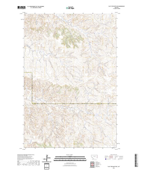
2024 Map of Flat Top Butte SW
USGS Topo · Published 2024About this map
Tenmile Creek and Flat Creek wind through the dissected landscape of this Montana territory along the border of Prairie and Custer counties. This topographic study reflects the rural character of the region as it appeared in the early 21st century, defined by seasonal drainage systems and a sparse network of backroads. The presence of Little Whitney Creek Rd provides one of the few named navigational landmarks through the terrain, highlighting the isolation and scale of these eastern Montana grasslands. Geographers and researchers can trace the natural convergence of Coal Creek and Deep Creek, which dictate the local topography and historical land use patterns across this sparsely populated section of the state.
Find a feature on this map
10 named features on this map. Tap any name to fly to it.
Don’t see what you’re looking for? This feature index may not catch every label — zoom into the map to look around manually.
Map Details
Editions of this 2024 Flat Top Butte SW Map
This is the sole edition of this map. No revisions or reprints were ever made.
Other maps of this area

1953 · Miles City
USGS Topo · 1:250,000

1957 · Miles City
USGS Topo · 1:250,000

1958 · Miles City
USGS Topo · 1:250,000

1969 · Little Whitney Creek
USGS Topo · 1:24,000

1969 · Spring Draw
USGS Topo · 1:24,000

1969 · Zero NE
USGS Topo · 1:24,000

1969 · Hogan Creek
USGS Topo · 1:24,000

1969 · Montague Butte
USGS Topo · 1:24,000

1969 · Flat Top Butte SW
USGS Topo · 1:24,000

1969 · Flat Top Butte
USGS Topo · 1:24,000