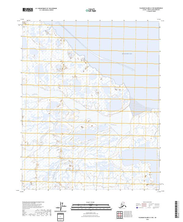
2024 Map of Flaxman Island A-3 SW
USGS Topo · Published 2024About this map
Arctic National Wildlife Refuge encompasses the majority of this coastal landscape, where the northern edge of the continent meets the Beaufort Sea. The geography is defined by a complex network of wetlands and tundra, bisected by the northward flow of the Canning River and the Tamayariak River. These watercourses meander through a low-lying plain before reaching the coast, where the map reveals a narrow barrier island or spit sheltering the mainland from the open sea. This environment represents a largely pristine stretch of the North Slope, where the absence of roads or permanent structures emphasizes the primacy of the hydrological systems and the protected status of the wildlife refuge.
Find a feature on this map
9 named features on this map. Tap any name to fly to it.
Don’t see what you’re looking for? This feature index may not catch every label — zoom into the map to look around manually.
Map Details
Editions of this 2024 Flaxman Island A-3 SW Map
This is the sole edition of this map. No revisions or reprints were ever made.
Other maps of this area

1951 · Mt. Michelson
USGS Topo · 1:250,000

1955 · Flaxman Island
USGS Topo · 1:250,000

1955 · Mount Michelson D-3
USGS Topo · 1:63,360

1955 · Mount Michelson D-4
USGS Topo · 1:63,360

1955 · Flaxman Island A-4
USGS Topo · 1:63,360

1955 · Flaxman Island A-3
USGS Topo · 1:63,360

1956 · Mt. Michelson
USGS Topo · 1:250,000
1962 · Flaxman Island A-4
USGS Topo · 1:50,000
2018 · Flaxman Island A-4 NE
USGS Topo · 1:25,000
2018 · Flaxman Island A-4 SE
USGS Topo · 1:25,000