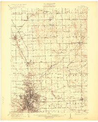
1922 Map of Flint
USGS Topo · Published 1922About this map
The city of Flint dominates the southern landscape of this 1920s-era survey, showing an urban core defined by the Flint River and a dense network of residential streets and industrial rail lines. The Pere Marquette and Grand Trunk Western railroads cut through the region, facilitating the movement of materials for the burgeoning automotive center. To the north, the landscape transitions into agricultural townships, dotted with numerous one-room schoolhouses like Wildcat School and Boutwell School, and small rural villages including Clio, Mount Morris, and Otisville.
Find a feature on this map
80 named features on this map. Tap any name to fly to it.
Don’t see what you’re looking for? This feature index may not catch every label — zoom into the map to look around manually.
Map Details
Editions of this 1922 Flint Map
3 editions found
Other maps of this area

1919 · Saginaw
USGS Topo · 1:62,500

1919 · Burt
USGS Topo · 1:62,500

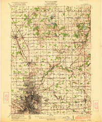
1920 · Flint
USGS Topo · 1:62,500

1920 · Holly
USGS Topo · 1:62,500

1921 · Burt
USGS Topo · 1:62,500

1922 · Holly
USGS Topo · 1:62,500

1922 · Durand
USGS Topo · 1:62,500

1922 · Flint
USGS Topo · 1:62,500

1941 · Saginaw
USGS Topo · 1:62,500

1943 · Holly
USGS Topo · 1:62,500