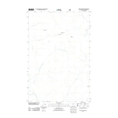
2011 Map of Flint Mountain
USGS Topo · Published 2011About this map
Triple Divide and Flint Mountain anchor this high-elevation landscape in Lewis and Clark County, where complex drainage patterns define the wilderness. The Continental Divide influences the flow of numerous watercourses, with the headwaters of the South Fork Sun River and the Dry Fork North Fork Blackfoot River moving toward different basins. This 2011 survey documents a preserved alpine environment devoid of modern settlements, dominated instead by prominent landmarks like Trident Peaks and Observation Point. A small alpine body of water, Sun Lake, is situated in the northeastern portion of the quadrangle. Significant drainages including Spring Creek, Bar Creek, and Cabin Creek carve through the terrain, highlighting the region's importance as a primary watershed for the surrounding Montana territories.
Find a feature on this map
14 named features on this map. Tap any name to fly to it.
Don’t see what you’re looking for? This feature index may not catch every label — zoom into the map to look around manually.
Map Details
Editions of this 2011 Flint Mountain Map
This is the sole edition of this map. No revisions or reprints were ever made.
Other maps of this area

1902 · Ovando
USGS Topo · 1:125,000

1903 · Coopers Lake
USGS Topo · 1:125,000

1905 · Ovando
USGS Topo · 1:125,000

1955 · Choteau
USGS Topo · 1:250,000

1957 · Choteau
USGS Topo · 1:250,000

1958 · Choteau
USGS Topo · 1:250,000

1962 · Choteau
USGS Topo · 1:250,000

1968 · Spread Mountain
USGS Topo · 1:24,000

1968 · Olson Peak
USGS Topo · 1:24,000
1968 · Lake Mountain
USGS Topo · 1:24,000