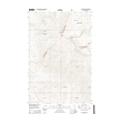
2014 Map of Flint Mountain
USGS Topo · Published 2014About this map
The Lewis and Clark Range dominates this portion of the Montana wilderness, where the high-altitude drainage systems of the Lewis & Clark National Forest, Flathead National Forest, and Lolo National Forest converge. At the center of this hydrological nexus is Triple Divide, a point where disparate watersheds begin their descent toward different basins. The rugged topography is defined by significant summits including Trident Peaks, Flint Mtn, and Evans Peak, which overlook a network of alpine waterways. From the secluded waters of Sun Lake, the S Fork Sun River flows northward, while the Dry Fork N Fork Blackfoot River and Cabin Cr carve deep paths through the timbered slopes to the south and west. This 2014 survey documents a landscape preserved as primitive forest, largely devoid of roads and human structures, focusing instead on the natural elevation and water systems like Spring Cr and Rapid Cr.
Find a feature on this map
31 named features on this map. Tap any name to fly to it.
Don’t see what you’re looking for? This feature index may not catch every label — zoom into the map to look around manually.
Map Details
Editions of this 2014 Flint Mountain Map
This is the sole edition of this map. No revisions or reprints were ever made.
Other maps of this area

1902 · Ovando
USGS Topo · 1:125,000

1903 · Coopers Lake
USGS Topo · 1:125,000

1905 · Ovando
USGS Topo · 1:125,000

1955 · Choteau
USGS Topo · 1:250,000

1957 · Choteau
USGS Topo · 1:250,000

1958 · Choteau
USGS Topo · 1:250,000

1962 · Choteau
USGS Topo · 1:250,000

1968 · Spread Mountain
USGS Topo · 1:24,000

1968 · Olson Peak
USGS Topo · 1:24,000
1968 · Lake Mountain
USGS Topo · 1:24,000