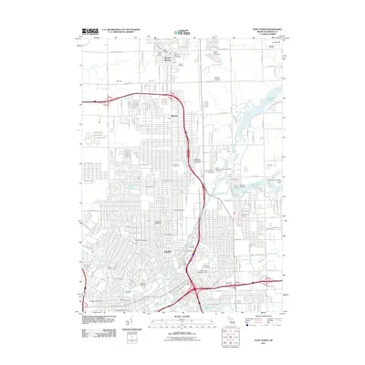
2011 Map of Flint North
USGS Topo · Published 2011About this map
Flint and its northern suburbs are defined by a complex network of waterways and educational institutions at the start of the 2010s. The Flint River winds through the urban core, joined by tributaries like Swartz Creek, Thread Creek, and Gilkey Creek. This landscape is a center of higher education, featuring the campuses of Kettering University and the University of Michigan - Flint. Northward, the communities of Beecher and Mount Morris provide a suburban transition, marked by the Genesee County Fairgrounds and the Mount Morris Post Office. The area's cultural and genealogical history is deeply etched into the land through numerous memorial sites, including the Assyrian Cemetery, Machpelah Cemetery, and Saint Michael's Byzantine Catholic Cemetery. Transportation and industry intersect at McGrew Junction, while recreational spaces like the Kearsley Lake Municipal Golf Course and Thread Lake offer green space amidst the grid of city streets.
Find a feature on this map
65 named features on this map. Tap any name to fly to it.
Don’t see what you’re looking for? This feature index may not catch every label — zoom into the map to look around manually.
Map Details
Editions of this 2011 Flint North Map
This is the sole edition of this map. No revisions or reprints were ever made.
Other maps of this area

1919 · Burt
USGS Topo · 1:62,500

1920 · Flint
USGS Topo · 1:62,500

1920 · Holly
USGS Topo · 1:62,500

1921 · Burt
USGS Topo · 1:62,500

1922 · Holly
USGS Topo · 1:62,500

1922 · Durand
USGS Topo · 1:62,500

1922 · Flint
USGS Topo · 1:62,500

1943 · Holly
USGS Topo · 1:62,500

1943 · Burt
USGS Topo · 1:62,500

1943 · Durand
USGS Topo · 1:62,500