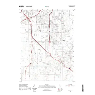
2019 Map of Flint South
USGS Topo · Published 2019About this map
Flint and its southern suburbs appear here in the late 2010s, showing a densely developed urban and industrial corridor transitioning into the residential expansions of Burton and Grand Blanc. The northern portion of the map is dominated by the sprawling infrastructure of Bishop International Airport and the academic presence of the Baker College of Flint. To the south, the landscape softens into a series of drainages and small water bodies like Crystal Lake and Case Lake, where older unincorporated communities like Whigville and Rankin maintain their identities amidst modern suburban growth.
Find a feature on this map
282 named features on this map. Tap any name to fly to it.
Don’t see what you’re looking for? This feature index may not catch every label — zoom into the map to look around manually.
Map Details
Editions of this 2019 Flint South Map
This is the sole edition of this map. No revisions or reprints were ever made.
Other maps of this area

1919 · Burt
USGS Topo · 1:62,500

1920 · Flint
USGS Topo · 1:62,500

1920 · Holly
USGS Topo · 1:62,500

1921 · Burt
USGS Topo · 1:62,500

1922 · Holly
USGS Topo · 1:62,500

1922 · Durand
USGS Topo · 1:62,500

1922 · Flint
USGS Topo · 1:62,500

1943 · Holly
USGS Topo · 1:62,500

1943 · Burt
USGS Topo · 1:62,500

1943 · Durand
USGS Topo · 1:62,500