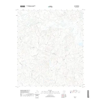
2019 Map of Flo
USGS Topo · Published 2019About this map
Flo sits at the heart of this East Texas landscape, where the headwaters and tributaries of several prominent creeks carve through the terrain. The settlement is surrounded by a network of rural routes such as FM 831 and FM 1511, which connect scattered homesteads and local landmarks. For those exploring local family histories, the area is notable for its concentration of small burial grounds, including Lummus Cem, Stevens Cem, and Wheelock Cem. These cemeteries are often located near the winding paths of Wheelock Cr and Red Oak Br. Further east, the waters of Schweinle Lake provide a rare break in the wooded landscape, situated just north of where the roads begin to descend toward the Buffalo Cr bottoms. The map captures a quintessential rural Texas layout, where drainage patterns like Resaca Cr and Serasca Cr heavily influence the placement of early roads and settlements.
Find a feature on this map
46 named features on this map. Tap any name to fly to it.
Don’t see what you’re looking for? This feature index may not catch every label — zoom into the map to look around manually.
Map Details
Editions of this 2019 Flo Map
This is the sole edition of this map. No revisions or reprints were ever made.
Other maps of this area

1919 · Fairfield
USGS Topo · 1:62,500

1953 · Palestine
USGS Topo · 1:250,000

1954 · Waco
USGS Topo · 1:250,000

1955 · Waco
USGS Topo · 1:250,000

1956 · Jewett
USGS Topo · 1:62,500

1957 · Palestine
USGS Topo · 1:250,000

1964 · Oakwood
USGS Topo · 1:24,000

1964 · Centerville
USGS Topo · 1:24,000

1964 · Flo
USGS Topo · 1:24,000

1964 · Eunice
USGS Topo · 1:24,000