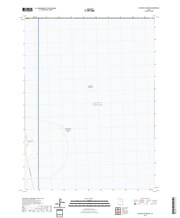
2023 Map of Floating Island NE
USGS Topo · Published 2023About this map
The vast expanse of the Great Salt Lake Desert dominates this Tooele County landscape, where the flat alkali surface is utilized for specialized modern operations. Much of the territory is occupied by the Utah Test and Training Range, a military reservation that defines the land use patterns of the region. Standing in stark contrast to the surrounding salt flats, the topographic relief of Floating Island rises on the western edge of the sheet, providing a rare landmark in an otherwise level environment. Human infrastructure is minimal, represented primarily by the Floating Island Dike Rd and the managed waters of the Newfoundland Evaporation Basin, illustrating the intersection of military testing grounds and industrial-scale mineral extraction in the Great Basin.
Find a feature on this map
6 named features on this map. Tap any name to fly to it.
Don’t see what you’re looking for? This feature index may not catch every label — zoom into the map to look around manually.
Map Details
Editions of this 2023 Floating Island NE Map
This is the sole edition of this map. No revisions or reprints were ever made.
Other maps of this area

1953 · Tooele
USGS Topo · 1:250,000

1954 · Brigham City
USGS Topo · 1:250,000

1955 · Tooele
USGS Topo · 1:250,000

1958 · Brigham City
USGS Topo · 1:250,000

1962 · Brigham City
USGS Topo · 1:250,000

1973 · Floating Island SW
USGS Topo · 1:24,000

1973 · Knolls 2 NW
USGS Topo · 1:24,000

1973 · Floating Island SE
USGS Topo · 1:24,000

1973 · Floating Island NE
USGS Topo · 1:24,000

1973 · Knolls 2 SW
USGS Topo · 1:24,000