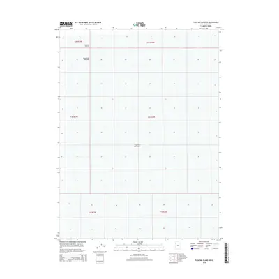
2014 Map of Floating Island SW
USGS Topo · Published 2014About this map
The expansive Great Salt Lake Desert dominates this Tooele County landscape, offering a stark look at one of the most distinctive geological regions in the American West. The survey highlights the northern reaches of the Bonneville Salt Flats, a renowned geological feature known for its level, salt-crusted surface. A specific human imprint on this otherwise desolate terrain is the International Racetrack Overrun, marking the northern limit of the famous speedway. This 2014 edition provides clear township and range boundaries, such as t2n r17w and t1n r16w, which define the cadastral grid across the vast salt crust. The lack of traditional topography or settlements emphasizes the unique environmental character of this portion of the desert, where the surface remains nearly perfectly flat for miles.
Find a feature on this map
9 named features on this map. Tap any name to fly to it.
Don’t see what you’re looking for? This feature index may not catch every label — zoom into the map to look around manually.
Map Details
Editions of this 2014 Floating Island SW Map
This is the sole edition of this map. No revisions or reprints were ever made.
Other maps of this area

1953 · Tooele
USGS Topo · 1:250,000

1955 · Tooele
USGS Topo · 1:250,000

1971 · Graham Peak
USGS Topo · 1:24,000

1971 · Bonneville Racetrack
USGS Topo · 1:24,000

1973 · Arinosa
USGS Topo · 1:24,000

1973 · Floating Island SW
USGS Topo · 1:24,000

1973 · Arinosa NE
USGS Topo · 1:24,000

1973 · Floating Island SE
USGS Topo · 1:24,000
1973 · Salduro
USGS Topo · 1:24,000

1973 · Floating Island NE
USGS Topo · 1:24,000