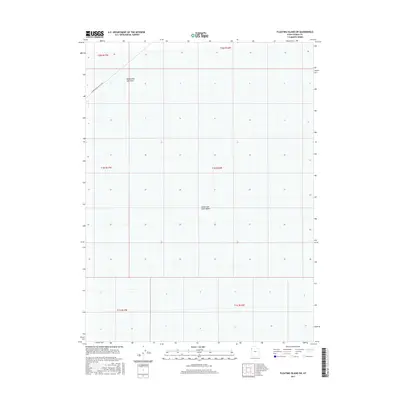
2017 Map of Floating Island SW
USGS Topo · Published 2017About this map
The Bonneville Salt Flats dominate this landscape, showcasing the famously level terrain of the Great Salt Lake Desert. This specific area in Tooele County captures a segment of the legendary International Racetrack, where the unique evaporative environment provides one of the flattest surfaces on earth for high-speed trials. The grid is defined by the Public Land Survey System, showing the boundaries between various townships such as t2n r17w and t1n r16w. Far from the typical settlement patterns of the American West, the map reveals a space defined almost entirely by its geology and its specialized role in automotive history, with few permanent structures or roads outside of the racing area.
Find a feature on this map
9 named features on this map. Tap any name to fly to it.
Don’t see what you’re looking for? This feature index may not catch every label — zoom into the map to look around manually.
Map Details
Editions of this 2017 Floating Island SW Map
This is the sole edition of this map. No revisions or reprints were ever made.
Other maps of this area

1953 · Tooele
USGS Topo · 1:250,000

1955 · Tooele
USGS Topo · 1:250,000

1971 · Graham Peak
USGS Topo · 1:24,000

1971 · Bonneville Racetrack
USGS Topo · 1:24,000

1973 · Arinosa
USGS Topo · 1:24,000

1973 · Floating Island SW
USGS Topo · 1:24,000

1973 · Arinosa NE
USGS Topo · 1:24,000

1973 · Floating Island SE
USGS Topo · 1:24,000
1973 · Salduro
USGS Topo · 1:24,000

1973 · Floating Island NE
USGS Topo · 1:24,000