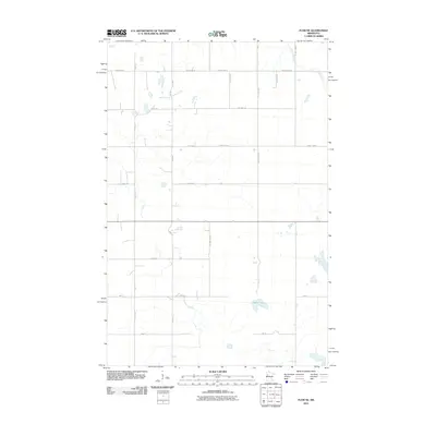
2011 Map of Flom NE
USGS Topo · Published 2011About this map
Apple Lake sits in the southeastern quadrant of this agricultural landscape in Becker County, surrounded by an orderly grid of section lines and township roads. The terrain is defined by its water and transport network, with Spring Creek meandering through the northern reaches. This 2011 survey illustrates a highly developed rural infrastructure where regional transit is managed by a hierarchy of routes, including County Hwy-8, County Hwy-10, and County Hwy-19. Local access is provided by numerous named thoroughfares such as Fossum Rd Se and Twp Hwy T-197. The map documents a classic Midwestern township layout, where small prairie depressions and wetlands are interspersed among the rectangular field patterns and established road corridors.
Find a feature on this map
25 named features on this map. Tap any name to fly to it.
Don’t see what you’re looking for? This feature index may not catch every label — zoom into the map to look around manually.
Map Details
Editions of this 2011 Flom NE Map
This is the sole edition of this map. No revisions or reprints were ever made.
Other maps of this area

1918 · Flom
USGS Topo · 1:62,500

1952 · Grand Forks
USGS Topo · 1:250,000

1954 · Bemidji
USGS Topo · 1:250,000

1956 · Grand Forks
USGS Topo · 1:250,000

1957 · Bemidji
USGS Topo · 1:250,000

1958 · Bemidji
USGS Topo · 1:250,000

1965 · Waukon
USGS Topo · 1:24,000

1966 · Flom
USGS Topo · 1:24,000

1966 · Grand Forks
USGS Topo · 1:250,000
1966 · Tilde Lake
USGS Topo · 1:24,000