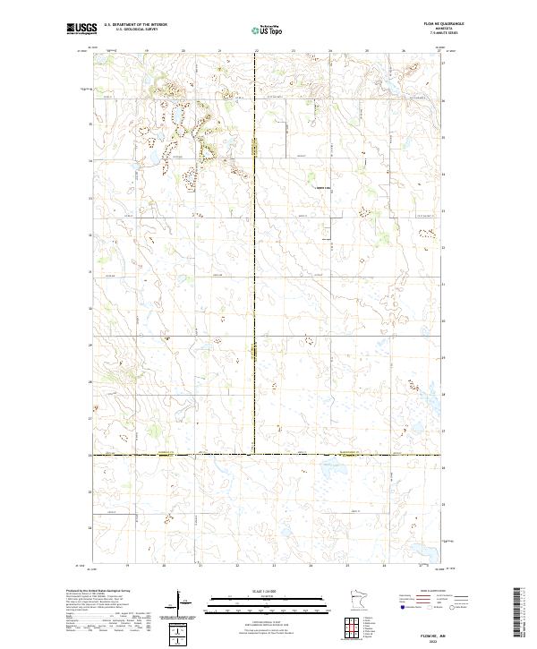
2022 Map of Flom NE
USGS Topo · Published 2022About this map
Mahnomen County terrain in the early 2020s is defined by a dense network of township roads and county highways that segment the landscape into a precise agricultural grid. This quadrangle captures the tri-county corner where Norman, Mahnomen, and Becker counties meet, a region characterized by a high concentration of prairie wetlands and small potholes. Surface water is concentrated in the southern and northeastern reaches, most notably at Apple Lake and along the winding course of Spring Cr. The dominance of roads like Co St Aid Hwy 6 and Twp Rd T-102 illustrates a deeply organized rural infrastructure where transport routes follow section lines, providing a clear record of land division and drainage patterns in this portion of northern Minnesota.
Find a feature on this map
28 named features on this map. Tap any name to fly to it.
Don’t see what you’re looking for? This feature index may not catch every label — zoom into the map to look around manually.
Map Details
Editions of this 2022 Flom NE Map
This is the sole edition of this map. No revisions or reprints were ever made.
Other maps of this area

1918 · Flom
USGS Topo · 1:62,500

1952 · Grand Forks
USGS Topo · 1:250,000

1954 · Bemidji
USGS Topo · 1:250,000

1956 · Grand Forks
USGS Topo · 1:250,000

1957 · Bemidji
USGS Topo · 1:250,000

1958 · Bemidji
USGS Topo · 1:250,000

1965 · Waukon
USGS Topo · 1:24,000

1966 · Flom
USGS Topo · 1:24,000

1966 · Grand Forks
USGS Topo · 1:250,000
1966 · Tilde Lake
USGS Topo · 1:24,000