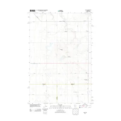
2013 Map of Flom
USGS Topo · Published 2013About this map
Flom and Fossum anchor this rural landscape in western Minnesota, where the borders of Norman, Clay, and Becker counties meet. The area is defined by a deep-rooted Lutheran heritage, evidenced by numerous burial grounds such as the Aspelund Norwegian Lutheran Cem and Immanuel Lutheran Cem. These sites, along with the Walworth Baptist Cem, serve as vital landmarks for genealogists tracing Scandinavian and pioneer families in the region. The terrain is marked by Frenchmans Bluff, which rises above the surrounding farmland and drainage networks like County Ditch Number Fortysix. These managed waterways, including Coon Cr, illustrate the transition of the native prairie into a highly organized agricultural grid. Local travel is facilitated by a network of section-line roads and state routes like MN-113, connecting small community centers and rural parishes.
Find a feature on this map
34 named features on this map. Tap any name to fly to it.
Don’t see what you’re looking for? This feature index may not catch every label — zoom into the map to look around manually.
Map Details
Editions of this 2013 Flom Map
This is the sole edition of this map. No revisions or reprints were ever made.
Other maps of this area

1918 · Twin Valley
USGS Topo · 1:62,500

1918 · Flom
USGS Topo · 1:62,500

1918 · Ulen
USGS Topo · 1:62,500

1952 · Grand Forks
USGS Topo · 1:250,000

1956 · Grand Forks
USGS Topo · 1:250,000

1965 · Waukon
USGS Topo · 1:24,000

1965 · Twin Valley
USGS Topo · 1:24,000

1965 · Syre
USGS Topo · 1:24,000

1966 · Flom
USGS Topo · 1:24,000

1966 · Grand Forks
USGS Topo · 1:250,000