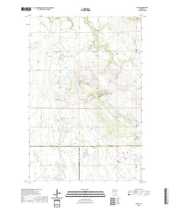
2022 Map of Flom
USGS Topo · Published 2022About this map
The agricultural landscape of Norman County and Becker County is defined by a grid of rural roads and scattered Lutheran churchyards. This region of northwest Minnesota centers on the small settlements of Fossum and Flom, where life is organized around the section lines and township boundaries of t143n r44w and t144n r44w. The terrain is generally flat, though Frenchmans Bluff provides a notable rise above the surrounding fields. Water management is a key feature of the local geography, seen in the path of Coon Cr and the engineered channel of County Ditch Number Fortysix. For genealogists, the map is a vital resource for locating remote burial sites such as the East Wild Rice Lutheran Cem, Immanuel Lutheran Cem, and the Aspelund Norwegian Lutheran Cem.
Find a feature on this map
44 named features on this map. Tap any name to fly to it.
Don’t see what you’re looking for? This feature index may not catch every label — zoom into the map to look around manually.
Map Details
Editions of this 2022 Flom Map
This is the sole edition of this map. No revisions or reprints were ever made.
Other maps of this area

1918 · Twin Valley
USGS Topo · 1:62,500

1918 · Flom
USGS Topo · 1:62,500

1918 · Ulen
USGS Topo · 1:62,500

1952 · Grand Forks
USGS Topo · 1:250,000

1956 · Grand Forks
USGS Topo · 1:250,000

1965 · Waukon
USGS Topo · 1:24,000

1965 · Twin Valley
USGS Topo · 1:24,000

1965 · Syre
USGS Topo · 1:24,000

1966 · Flom
USGS Topo · 1:24,000

1966 · Grand Forks
USGS Topo · 1:250,000