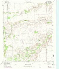
1967 Map of Flomot
USGS Topo · Published 1981About this map
Flomot sits on the high plains of the Texas Panhandle, anchoring a landscape where agriculture and cattle ranching are dictated by the deep incisions of the North Pease River. This 1967 survey, updated with 1979 aerial revisions, reveals the vital importance of water management in Motley County, noted by the presence of isolated cattle landmarks like West Windmill and Twin Windmill.
Find a feature on this map
16 named features on this map. Tap any name to fly to it.
Don’t see what you’re looking for? This feature index may not catch every label — zoom into the map to look around manually.
Map Details
Editions of this 1967 Flomot Map
2 editions found
Other maps of this area

1954 · Plainview
USGS Topo · 1:250,000

1958 · Plainview
USGS Topo · 1:250,000

1966 · Matador
USGS Topo · 1:24,000

1967 · Quitaque
USGS Topo · 1:24,000

1967 · North Windmill
USGS Topo · 1:24,000

1967 · Quitaque Peaks
USGS Topo · 1:24,000

1967 · Dick Moore Canyon
USGS Topo · 1:24,000

1967 · Hornica Creek
USGS Topo · 1:24,000

1967 · Flomot
USGS Topo · 1:24,000

1967 · Whiteflat
USGS Topo · 1:24,000