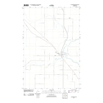
2010 Map of Floodwood
USGS Topo · Published 2010About this map
Floodwood serves as the focal point of this northern Minnesota landscape, situated at the confluence of the Floodwood River and the Saint-Louis River. The town's layout is clearly defined by the Floodwood Post Office and local landmarks like the Floodwood Cemetery. To the south, the East Savanna River meanders through the terrain, illustrating the complex hydrology of Saint Louis County.
Find a feature on this map
39 named features on this map. Tap any name to fly to it.
Don’t see what you’re looking for? This feature index may not catch every label — zoom into the map to look around manually.
Map Details
Editions of this 2010 Floodwood Map
This is the sole edition of this map. No revisions or reprints were ever made.
Other maps of this area

1953 · Duluth
USGS Topo · 1:250,000

1954 · Hibbing
USGS Topo · 1:250,000

1957 · Hibbing
USGS Topo · 1:250,000

1958 · Hibbing
USGS Topo · 1:250,000

1958 · Duluth
USGS Topo · 1:250,000

1963 · Gowan
USGS Topo · 1:24,000

1963 · Prairie Lake
USGS Topo · 1:24,000

1963 · Elmer
USGS Topo · 1:24,000

1963 · Toivola SW
USGS Topo · 1:24,000
1963 · Mc Carty River
USGS Topo · 1:24,000