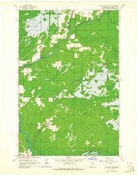
1963 Map of Mc Carty River
USGS Topo · Published 1964About this map
The confluence of northern Minnesota waterways defines this 1963 landscape, where the St Louis River and Whiteface River meet. This terrain, mapped just before the mid-1960s, is a complex network of wetlands and seasonal drainages, dominated by the expansive Toivola Swamp to the northwest. The presence of the Great Northern railroad line cutting through the southwestern corner underscores the area's importance to regional transit and resource extraction.
Find a feature on this map
11 named features on this map. Tap any name to fly to it.
Don’t see what you’re looking for? This feature index may not catch every label — zoom into the map to look around manually.
Map Details
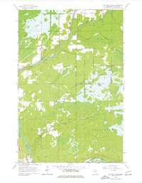
Editions of this 1963 Mc Carty River Map
2 editions found
Other maps of this area

1953 · Brookston NW
USGS Topo · 1:24,000

1953 · Duluth
USGS Topo · 1:250,000

1954 · Martin Lake
USGS Topo · 1:24,000

1954 · Hibbing
USGS Topo · 1:250,000

1957 · Hibbing
USGS Topo · 1:250,000

1958 · Hibbing
USGS Topo · 1:250,000

1958 · Duluth
USGS Topo · 1:250,000

1963 · Gowan
USGS Topo · 1:24,000

1963 · Prairie Lake
USGS Topo · 1:24,000

1963 · Elmer
USGS Topo · 1:24,000