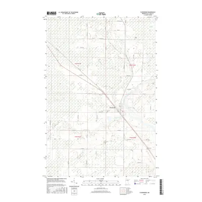
2016 Map of Floodwood
USGS Topo · Published 2016About this map
The Floodwood settlement sits at the strategic confluence of three waterways, where the Floodwood River and the E Savanna River both join the larger Saint Louis River. This 2016 survey highlights a landscape dominated by the extensive Toivola Swamp to the northeast, illustrating the wetland character of this part of Saint Louis County. The rural road network reflects family-named routes and local history, including Pokonen Rd, Haanpaa, and Adams Rd. Genealogists will find several burial grounds documented across the townships, such as Forest-Hill Cem to the north and Hope Cem located in the southeastern quadrant near Twp Rd 5028. The map serves as a contemporary record of how transportation corridors like the St Vincent Rd and Co Rd 835 interface with the area's complex river system.
Find a feature on this map
50 named features on this map. Tap any name to fly to it.
Don’t see what you’re looking for? This feature index may not catch every label — zoom into the map to look around manually.
Map Details
Editions of this 2016 Floodwood Map
This is the sole edition of this map. No revisions or reprints were ever made.
Other maps of this area

1953 · Duluth
USGS Topo · 1:250,000

1954 · Hibbing
USGS Topo · 1:250,000

1957 · Hibbing
USGS Topo · 1:250,000

1958 · Hibbing
USGS Topo · 1:250,000

1958 · Duluth
USGS Topo · 1:250,000

1963 · Gowan
USGS Topo · 1:24,000

1963 · Prairie Lake
USGS Topo · 1:24,000

1963 · Elmer
USGS Topo · 1:24,000

1963 · Toivola SW
USGS Topo · 1:24,000
1963 · Mc Carty River
USGS Topo · 1:24,000