
1951 Map of Flora
USGS Topo · Published 1953About this map
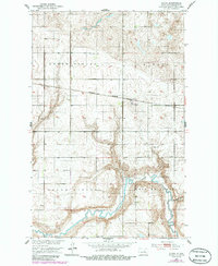
The Northern Pacific railroad cuts a straight line through the glacial till of Benson County, anchoring the small community of Flora. This early 1950s survey captures a quintessential North Dakota prairie landscape organized by the section lines of North Viking, Aurora, South Viking, and West Antelope townships. The most dramatic topographic relief is found in the south, where the Sheyenne River meanders through a deep valley, joined by the distinctive Peterson Coulee. Local civic life is evidenced by the presence of a Town Hall and rural education centers like School No. 4 and School No. 8. For those tracing family histories, the map identifies several local landmarks including Maddock Cem and Flora Cem, alongside industrial markers like the Gravel Pit along the river bluffs.
Find a feature on this map
14 named features on this map. Tap any name to fly to it.
Don’t see what you’re looking for? This feature index may not catch every label — zoom into the map to look around manually.
Map Details
Editions of this 1951 Flora Map
2 editions found
Other maps of this area

1932 · Flora
USGS Topo · 1:62,500

1943 · Maddock
USGS Topo · 1:62,500

1945 · Maddock
USGS Topo · 1:62,500

1951 · Flora SE
USGS Topo · 1:24,000

1951 · Black Hammer Hill
USGS Topo · 1:24,000

1951 · Josephine
USGS Topo · 1:24,000

1951 · Maddock
USGS Topo · 1:24,000
1951 · Hamberg
USGS Topo · 1:24,000

1951 · Flora
USGS Topo · 1:62,500

1952 · New Rockford
USGS Topo · 1:250,000