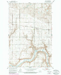
1951 Map of Flora
USGS Topo · Published 1986About this map
The Sheyenne River winds through the southern reaches of this landscape, carving a distinct valley through the townships of South Viking and West Antelope. At the center of the northern section, the settlement of Flora serves as a local hub along the Burlington Northern railroad line. This 1951 survey, with revisions noted in 1982, captures a mid-century rural infrastructure characterized by dispersed community landmarks such as School No. 4, School No. 8, and the Town Hall. Genealogical interest is found at the Maddock Cem and Flora Cem, while the industrial presence is limited to local resources like a Gravel Pit near Peterson Coulee. The map illustrates the rigid section lines of the Public Land Survey System as they intersect with the natural, undulating drainage patterns of the prairie.
Find a feature on this map
15 named features on this map. Tap any name to fly to it.
Don’t see what you’re looking for? This feature index may not catch every label — zoom into the map to look around manually.
Map Details
Editions of this 1951 Flora Map
2 editions found
Other maps of this area

1932 · Flora
USGS Topo · 1:62,500

1943 · Maddock
USGS Topo · 1:62,500

1945 · Maddock
USGS Topo · 1:62,500

1951 · Flora SE
USGS Topo · 1:24,000

1951 · Black Hammer Hill
USGS Topo · 1:24,000

1951 · Flora
USGS Topo · 1:24,000

1951 · Josephine
USGS Topo · 1:24,000

1951 · Maddock
USGS Topo · 1:24,000
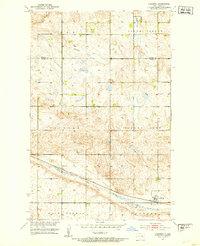
1951 · Hamberg
USGS Topo · 1:24,000

1951 · Flora
USGS Topo · 1:62,500