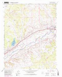
1963 Map of Flora Vista
USGS Topo · Published 1980About this map
The Animas River valley serves as the central corridor for this 1963 survey, where an intricate network of irrigation canals like the Farmers Ditch and Elledge Mill Ditch supports the riverside agricultural economy. This mid-century view shows the growing settlements of Aztec, Flora Vista, and Spencerville during a period of infrastructure expansion. Transportation and industrial development are evident through the Denver and Rio Grande Western Railroad and the path of U.S. Highway 550, which parallel the river's course.
Find a feature on this map
41 named features on this map. Tap any name to fly to it.
Don’t see what you’re looking for? This feature index may not catch every label — zoom into the map to look around manually.
Map Details
Editions of this 1963 Flora Vista Map
4 editions found
Other maps of this area

1889 · Largo
USGS Topo · 1:250,000

1889 · Chaco
USGS Topo · 1:250,000

1892 · Chaco
USGS Topo · 1:250,000

1895 · Largo
USGS Topo · 1:250,000

1954 · Shiprock
USGS Topo · 1:250,000

1954 · Aztec
USGS Topo · 1:250,000

1958 · Shiprock
USGS Topo · 1:250,000

1958 · Aztec
USGS Topo · 1:250,000

1959 · Shiprock
USGS Topo · 1:250,000

1959 · Aztec
USGS Topo · 1:62,500