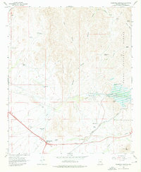
1966 Map of Florence Junction
USGS Topo · Published 1976About this map
Florence Junction serves as the primary focal point of this Pinal County landscape, situated at the intersection of major desert thoroughfares during the mid-1960s. The area is defined by a transition from managed ranching lands like Burns Ranch and San Mateo Castro Ranch to the more dramatic terrain of the Tonto National Forest. Water management is central to the local geography, evidenced by the extensive Whitlow Ranch Flood Control Basin on Queen Creek and numerous livestock tanks such as Apache Land Tank and Queen Creek Tank.
Find a feature on this map
40 named features on this map. Tap any name to fly to it.
Don’t see what you’re looking for? This feature index may not catch every label — zoom into the map to look around manually.
Map Details
Editions of this 1966 Florence Junction Map
3 editions found
Other maps of this area

1900 · Florence
USGS Topo · 1:125,000

1902 · Florence
USGS Topo · 1:125,000

1948 · Superior
USGS Topo · 1:62,500

1948 · Iron Mountain
USGS Topo · 1:24,000

1948 · Picketpost Mtn
USGS Topo · 1:24,000

1949 · Iron Mountain
USGS Topo · 1:24,000

1949 · Picketpost Mtn
USGS Topo · 1:24,000

1954 · Mesa
USGS Topo · 1:250,000

1956 · Goldfield
USGS Topo · 1:24,000

1956 · Magma
USGS Topo · 1:24,000