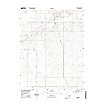
2015 Map of Florence
USGS Topo · Published 2015About this map
Florence occupies the bend of the Cottonwood River in Marion County, where the convergence of Doyle Cr and the river creates a focal point for settlement. This modern survey illustrates the enduring grid of the Kansas plains, with established rural routes like Wagonwheel Rd and Vista Rd dividing the landscape into regular sections. Away from the town center, several notable landmarks for local history and genealogy remain visible, including Mount Calvary Cem to the west and Allison Cem to the south. The terrain is marked by significant natural water sources such as Coyne Spring and Lee Spring, which feed into the drainage systems of Spring Cr. The persistence of these named springs and cemeteries alongside the contemporary road network allows for a clear comparison between historical land use and current property boundaries across the T21S and T22S townships.
Find a feature on this map
39 named features on this map. Tap any name to fly to it.
Don’t see what you’re looking for? This feature index may not catch every label — zoom into the map to look around manually.
Map Details
Editions of this 2015 Florence Map
This is the sole edition of this map. No revisions or reprints were ever made.
Other maps of this area

1889 · Newton
USGS Topo · 1:125,000

1894 · Newton
USGS Topo · 1:125,000

1898 · Cottonwood Falls
USGS Topo · 1:125,000

1955 · Hutchinson
USGS Topo · 1:250,000

1957 · Florence
USGS Topo · 1:24,000

1957 · Wonsevu
USGS Topo · 1:24,000

1957 · Cedar Point
USGS Topo · 1:24,000

1957 · Lincolnville SW
USGS Topo · 1:24,000

1957 · Peabody
USGS Topo · 1:24,000

1959 · Hutchinson
USGS Topo · 1:250,000