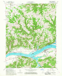
1966 Map of Florence
USGS Topo · Published 1968About this map
The Ohio River forms a dominant curve through this 1966 survey, serving as the natural boundary between Switzerland Co, Indiana, and Gallatin Co, Kentucky. The riverfront infrastructure of the mid-1960s is on full display, anchored by the massive Markland Locks and Dam and its adjacent Powerplant. On the Kentucky side, the town of Warsaw is a focal point with its High Sch and residential street grid, while the Indiana shoreline features the river landing at Florence and a nearby Boat Ramp near the mouth of Craigs Creek.
Find a feature on this map
47 named features on this map. Tap any name to fly to it.
Don’t see what you’re looking for? This feature index may not catch every label — zoom into the map to look around manually.
Map Details
Editions of this 1966 Florence Map
4 editions found
Other maps of this area

1943 · Florence
USGS Topo · 1:24,000

1943 · Aberdeen
USGS Topo · 1:24,000

1943 · Vevay North
USGS Topo · 1:24,000

1943 · Rising Sun
USGS Topo · 1:24,000

1943 · Patriot
USGS Topo · 1:24,000

1943 · Vevay South
USGS Topo · 1:24,000

1950 · Glencoe
USGS Topo · 1:24,000

1951 · Florence
USGS Topo · 1:24,000

1951 · Rising Sun
USGS Topo · 1:24,000

1951 · Sanders
USGS Topo · 1:24,000