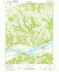
1966 Map of Florence
USGS Topo · Published 1979About this map
The Ohio River serves as the dominant boundary between Switzerland County, Indiana and Gallatin County, Kentucky, anchoring a landscape defined by steep ridges and narrow creek valleys. Significant industrial and maritime infrastructure is concentrated along the riverbanks, most notably the Markland Locks and Dam and its associated powerplant. These modern engineering works contrast with the long-established upland farming communities such as East Enterprise and Quercus Grove, which are situated along a network of ridge-top roads including Seymour Road and Keith Road.
Find a feature on this map
64 named features on this map. Tap any name to fly to it.
Don’t see what you’re looking for? This feature index may not catch every label — zoom into the map to look around manually.
Map Details
Editions of this 1966 Florence Map
4 editions found
Other maps of this area

1943 · Florence
USGS Topo · 1:24,000

1943 · Aberdeen
USGS Topo · 1:24,000

1943 · Vevay North
USGS Topo · 1:24,000

1943 · Rising Sun
USGS Topo · 1:24,000

1943 · Patriot
USGS Topo · 1:24,000

1943 · Vevay South
USGS Topo · 1:24,000

1950 · Glencoe
USGS Topo · 1:24,000

1951 · Florence
USGS Topo · 1:24,000

1951 · Rising Sun
USGS Topo · 1:24,000

1951 · Sanders
USGS Topo · 1:24,000