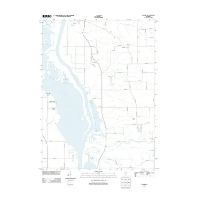
2012 Map of Florid
USGS Topo · Published 2012About this map
The Illinois River corridor in Marshall County is defined by its sprawling backwater lakes and bottomland geography. This riverine landscape includes expansive bodies of water such as Senachwine Lake, Swan Lake, and Sawmill Lake, which dominate the western half of the map. Along the river's eastern bluffs, small settlements like Walnut Grove, Indian Spring, and Undercliff sit near the water’s edge, while the town of Florid is established further inland on the agricultural plateau.
Find a feature on this map
65 named features on this map. Tap any name to fly to it.
Don’t see what you’re looking for? This feature index may not catch every label — zoom into the map to look around manually.
Map Details
Editions of this 2012 Florid Map
This is the sole edition of this map. No revisions or reprints were ever made.
Other maps of this area

1893 · Lacon
USGS Topo · 1:62,500

1893 · Hennepin
USGS Topo · 1:62,500

1893 · Lasalle
USGS Topo · 1:62,500

1909 · Hennepin
USGS Topo · 1:62,500

1911 · La Salle
USGS Topo · 1:62,500

1911 · Hennepin
USGS Topo · 1:62,500

1913 · La Salle
USGS Topo · 1:62,500

1933 · Lacon
USGS Topo · 1:62,500

1934 · Wenona
USGS Topo · 1:48,000

1937 · Lacon
USGS Topo · 1:62,500