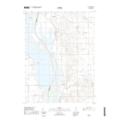
2018 Map of Florid
USGS Topo · Published 2018About this map
Senachwine Lake and a series of interconnected backwater basins dominate the western half of this landscape, forming a complex wetland system along the Illinois River. The settlement of Hennepin sits at a strategic bend in the river to the north, while Henry anchors the southwestern corner. These communities are linked by a network of rural routes such as Hennepin Florid Rd and Hennepin Farms Rd, which traverse the flat agricultural uplands east of the river valley. Local history is anchored by several small cemeteries, including Riverside Cem and Union Grove Cem, which serve as markers of early settlement in Putnam and Marshall counties. The map captures the specialized geography of the river bottoms, where features like Swan Lake, Sawmill Lake, and the winding course of Clear Cr illustrate the persistent influence of the Illinois River's floodway on local land use and boundaries.
Find a feature on this map
78 named features on this map. Tap any name to fly to it.
Don’t see what you’re looking for? This feature index may not catch every label — zoom into the map to look around manually.
Map Details
Editions of this 2018 Florid Map
This is the sole edition of this map. No revisions or reprints were ever made.
Other maps of this area

1893 · Lacon
USGS Topo · 1:62,500

1893 · Hennepin
USGS Topo · 1:62,500

1893 · Lasalle
USGS Topo · 1:62,500

1909 · Hennepin
USGS Topo · 1:62,500

1911 · La Salle
USGS Topo · 1:62,500

1911 · Hennepin
USGS Topo · 1:62,500

1913 · La Salle
USGS Topo · 1:62,500

1933 · Lacon
USGS Topo · 1:62,500

1934 · Wenona
USGS Topo · 1:48,000

1937 · Lacon
USGS Topo · 1:62,500