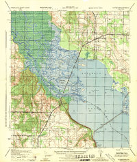
1944 Map of Floridatown
USGS Topo · Published 1944About this map
Ellyson Field stands as a prominent military installation on this wartime survey of the Florida panhandle. The complex network of the Escambia River delta dominates the landscape, featuring a maze of waterways like Little River, White River, and Simpson River that weave around Noriegas Island. This intricate hydrologic system transitions into the broad waters of Escambia Bay, where survey markers like East River BN 1934 and West Head 1934 define the shoreline near Floridatown.
Find a feature on this map
32 named features on this map. Tap any name to fly to it.
Don’t see what you’re looking for? This feature index may not catch every label — zoom into the map to look around manually.
Map Details
Editions of this 1944 Floridatown Map
This is the sole edition of this map. No revisions or reprints were ever made.
Other maps of this area

1920 · Milton
USGS Topo · 1:62,500

1921 · Pensacola
USGS Topo · 1:62,500

1921 · Fort Barrancas
USGS Topo · 1:62,500

1921 · Muscogee
USGS Topo · 1:62,500

1941 · Fort Barrancas
USGS Topo · 1:62,500

1941 · Muscogee
USGS Topo · 1:62,500

1941 · Pensacola
USGS Topo · 1:62,500

1941 · Milton
USGS Topo · 1:62,500

1942 · Pensacola
USGS Topo · 1:62,500

1943 · Muscogee
USGS Topo · 1:62,500