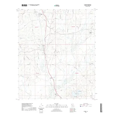
2018 Map of Florien
USGS Topo · Published 2018About this map
Florien serves as a central hub in Sabine Parish, where the local road network converges around the north-south transit corridor. This late-2010s survey details a landscape defined by the drainage of Bayou Toro and Midkiff Cr, illustrating how modern infrastructure follows the older topographic contours of the piney woods. Rural life is anchored by family and community landmarks such as Lewing Cem and Mount Carmel, while the wetlands south of Gandy reveal a complex system of bayous and named islands including Nandina Island and Bear Island. The map provides a clear picture of the transition from the small-town street grids of Fisher to the scattered homesteads and timber roads that define the region's southern reaches near Sandel.
Find a feature on this map
90 named features on this map. Tap any name to fly to it.
Don’t see what you’re looking for? This feature index may not catch every label — zoom into the map to look around manually.
Map Details
Editions of this 2018 Florien Map
This is the sole edition of this map. No revisions or reprints were ever made.
Other maps of this area

1941 · Zwolle
USGS Topo · 1:62,500

1942 · Many
USGS Topo · 1:62,500

1942 · Florien
USGS Topo · 1:62,500

1943 · Many
USGS Topo · 1:62,500

1944 · Negreet
USGS Topo · 1:62,500

1944 · Florien
USGS Topo · 1:62,500

1944 · Zwolle
USGS Topo · 1:62,500

1953 · Alexandria
USGS Topo · 1:250,000

1954 · Toro
USGS Topo · 1:24,000

1954 · Florien
USGS Topo · 1:62,500