
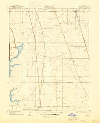
1909 Map of Florin
USGS Topo · Published 1909About this map
Agricultural development across the Sacramento Valley floor is captured in this 1909 survey, highlighting the corridor between Florin and Franklin. The landscape is defined by the early infrastructure of the Southern Pacific RR and the Western Pacific RR, which run parallel to the historic transit routes of Upper Stockton Road and Lower Stockton Road. These arteries supported small rural hubs and post offices like Union House and Graham, serving a farming community reliant on local education centers such as Prairie School and Elk Grove School. Along the western edge, the complex hydrology of the delta region is evident in the sprawling waters of Beach Lake and Stone Lake, joined by the Sacramento Drainage Canal. This map offers a precise look at the land use and drainage patterns of Sacramento County before modern suburban expansion transformed these family-named settlements into the outskirts of the capital city.
Find a feature on this map
15 named features on this map. Tap any name to fly to it.
Don’t see what you’re looking for? This feature index may not catch every label — zoom into the map to look around manually.
Map Details
Editions of this 1909 Florin Map
2 editions found
Other maps of this area

1891 · Sacramento
USGS Topo · 1:125,000

1892 · Sacramento
USGS Topo · 1:125,000

1893 · Sacramento
USGS Topo · 1:125,000

1894 · Lodi
USGS Topo · 1:125,000

1902 · Fairoaks
USGS Topo · 1:62,500

1907 · Davisville
USGS Topo · 1:62,500

1908 · Courtland
USGS Topo · 1:62,500

1909 · Elk Grove
USGS Topo · 1:31,680

1910 · Bruceville
USGS Topo · 1:31,680

1910 · Galt
USGS Topo · 1:31,680