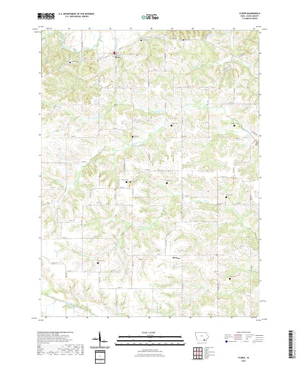
2022 Map of Floris
USGS Topo · Published 2022About this map
Floris serves as the primary community in this section of Davis County, situated just south of Soap Creek near the junction of Co HWY j15. The landscape is defined by the complex drainage systems of the Fox River and Chequest Creek, which carve intricate patterns through the township. This modern survey reveals a deeply rooted rural history preserved in its numerous family and community burial sites. Beyond the town limits, small settlements like Shunem appear alongside a remarkable density of named cemeteries including Wilson Cemetery, Pagett Cemetery, and Stark Cemetery. The map also identifies the isolated Cupp Grave in the south, suggesting a legacy of early pioneer settlement and family homesteads that persisted into the twenty-first century. A network of secondary roads and trails, such as Silver Trail and Oxen Trail, provides access to these remote reaches of the Iowa countryside.
Find a feature on this map
54 named features on this map. Tap any name to fly to it.
Don’t see what you’re looking for? This feature index may not catch every label — zoom into the map to look around manually.
Map Details
Editions of this 2022 Floris Map
This is the sole edition of this map. No revisions or reprints were ever made.
Other maps of this area

1954 · Centerville
USGS Topo · 1:250,000

1956 · Agency
USGS Topo · 1:24,000

1956 · Ottumwa South
USGS Topo · 1:24,000

1956 · Ottumwa South
USGS Topo · 1:62,500

1957 · Centerville
USGS Topo · 1:250,000

1958 · Centerville
USGS Topo · 1:250,000
1965 · Eldon
USGS Topo · 1:24,000

1965 · Selma
USGS Topo · 1:24,000
1970 · Milton
USGS Topo · 1:24,000
1979 · Floris
USGS Topo · 1:24,000