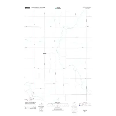
2013 Map of Floyd
USGS Topo · Published 2013About this map
The Cedar River and Little Cedar River define the agricultural landscape of this northern Iowa region, winding through a grid of rural section roads. The settlement of Floyd is situated near the riverbanks in the southwestern corner, where a small network of streets including Liberty St and Pearl St cluster together. To the north and east, the unincorporated communities of Howardville and Nilesville anchor the surrounding farmland. The terrain is further etched by smaller waterways such as Fish Cr and Slough Cr, which cut through the surveyed road system. This 2013 survey provides a contemporary record of traditional land divisions and the persistent small-town centers of Floyd County, showing how modern infrastructure follows the paths established by these waterways.
Find a feature on this map
34 named features on this map. Tap any name to fly to it.
Don’t see what you’re looking for? This feature index may not catch every label — zoom into the map to look around manually.
Map Details
Editions of this 2013 Floyd Map
This is the sole edition of this map. No revisions or reprints were ever made.
Other maps of this area

1954 · Mason City
USGS Topo · 1:250,000

1957 · Mason City
USGS Topo · 1:250,000

1958 · Mason City
USGS Topo · 1:250,000

1971 · Orchard
USGS Topo · 1:24,000

1971 · Charles City
USGS Topo · 1:24,000

1971 · Bassett
USGS Topo · 1:24,000

1971 · Colwell
USGS Topo · 1:24,000

1971 · Floyd
USGS Topo · 1:24,000
1971 · Roseville
USGS Topo · 1:24,000

1972 · Osage
USGS Topo · 1:24,000