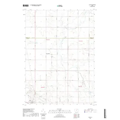
2018 Map of Floyd
USGS Topo · Published 2018About this map
The Cedar River and Little Cedar River converge in the southwest corner of this landscape, framing the town of Floyd. This area of northern Iowa, split by the Mitchell Co Floyd Co line, is defined by its grid-based rural settlement and agricultural heritage. Further north, the small community of Howardville sits along Quail Ave, accompanied by the Howardville Cem. The map provides a detailed look at the local infrastructure including Co Hwy T54 and the residential streets of Floyd like Liberty St and Pearl St. Near the northern border, the Stillwater Cem and Fish Cr mark the transition into Mitchell County, while the undulating terrain near Slough Cr shows the natural drainage patterns that have influenced land use in the region for generations.
Find a feature on this map
43 named features on this map. Tap any name to fly to it.
Don’t see what you’re looking for? This feature index may not catch every label — zoom into the map to look around manually.
Map Details
Editions of this 2018 Floyd Map
This is the sole edition of this map. No revisions or reprints were ever made.
Other maps of this area

1954 · Mason City
USGS Topo · 1:250,000

1957 · Mason City
USGS Topo · 1:250,000

1958 · Mason City
USGS Topo · 1:250,000

1971 · Orchard
USGS Topo · 1:24,000

1971 · Charles City
USGS Topo · 1:24,000

1971 · Bassett
USGS Topo · 1:24,000

1971 · Colwell
USGS Topo · 1:24,000

1971 · Floyd
USGS Topo · 1:24,000
1971 · Roseville
USGS Topo · 1:24,000

1972 · Osage
USGS Topo · 1:24,000