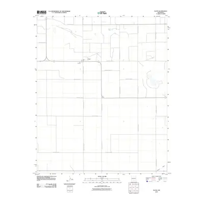
2010 Map of Floyd
USGS Topo · Published 2010About this map
Floyd serves as the central hub of this agricultural landscape in Roosevelt County, characterized by a highly structured grid of section lines and rural thoroughfares. The settlement is anchored by local infrastructure including the Floyd Post Office and the nearby Floyd Cemetery, which offers a focal point for genealogical research in the area. The surrounding terrain is defined by a sparse distribution of water features, most notably Smith Lake in the northern portion of the quadrangle and the intermittent path of Boone Draw to the south. This network of roads, such as S Roosevelt Road 3 and S Roosevelt Road AG, illustrates the organized land management patterns typical of the High Plains, where residential clusters are often tied to these primary intersections and localized water sources.
Find a feature on this map
18 named features on this map. Tap any name to fly to it.
Don’t see what you’re looking for? This feature index may not catch every label — zoom into the map to look around manually.
Map Details
Editions of this 2010 Floyd Map
This is the sole edition of this map. No revisions or reprints were ever made.
Other maps of this area

1954 · Clovis
USGS Topo · 1:250,000

1957 · Portair
USGS Topo · 1:62,500

1957 · Melrose
USGS Topo · 1:62,500

1957 · Portales
USGS Topo · 1:62,500

1958 · Clovis
USGS Topo · 1:250,000

1973 · Floyd
USGS Topo · 1:24,000

1973 · Lewiston Lake
USGS Topo · 1:24,000

1973 · Tule Lake
USGS Topo · 1:24,000

1973 · Upton
USGS Topo · 1:24,000

1973 · Floyd SE
USGS Topo · 1:24,000