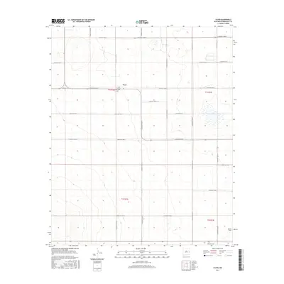
2017 Map of Floyd
USGS Topo · Published 2017About this map
The agricultural community of Floyd anchors this high plains landscape of Roosevelt County. Situated at the intersection of a rigid grid of country roads, including S Roosevelt Road 3 and S Roosevelt Road AG, the small settlement is closely tied to the surrounding section lines. Local history is centered at the Floyd Cem on the town's edge, a critical site for genealogical research in the area. The terrain is largely defined by subtle depressions and drainage patterns, most notably the seasonal Tierra Blanca Lake to the east and the sweeping path of Boone Draw in the south. This survey illustrates the persistence of the Public Land Survey System, where every section, from t1s r32e to t2s r33e, is systematically partitioned by a network of numbered Roosevelt roads.
Find a feature on this map
26 named features on this map. Tap any name to fly to it.
Don’t see what you’re looking for? This feature index may not catch every label — zoom into the map to look around manually.
Map Details
Editions of this 2017 Floyd Map
This is the sole edition of this map. No revisions or reprints were ever made.
Other maps of this area

1954 · Clovis
USGS Topo · 1:250,000

1957 · Portair
USGS Topo · 1:62,500

1957 · Melrose
USGS Topo · 1:62,500

1957 · Portales
USGS Topo · 1:62,500

1958 · Clovis
USGS Topo · 1:250,000

1973 · Floyd
USGS Topo · 1:24,000

1973 · Lewiston Lake
USGS Topo · 1:24,000

1973 · Tule Lake
USGS Topo · 1:24,000

1973 · Upton
USGS Topo · 1:24,000

1973 · Floyd SE
USGS Topo · 1:24,000