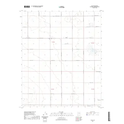
2020 Map of Floyd
USGS Topo · Published 2020About this map
Floyd serves as the central community of this high plains landscape in Roosevelt County, where the grid of the Public Land Survey System defines the human footprint. The map documents a predominantly agricultural area organized by an extensive network of numbered roads, such as S Roosevelt Road 3 and S Roosevelt Road 1. This rigid geometry is interrupted only by natural depressions and drainage features, most notably Tierra Blanca Lake and the intermittent path of Boone Draw in the southern portion of the quadrangle. For those researching local family history or land use, the location of the Floyd Cem west of the main settlement provides a key genealogical landmark. The terrain's gentle contours reflect the characteristic topography of the Llano Estacado, where water management and road placement are the primary indicators of settlement patterns.
Find a feature on this map
24 named features on this map. Tap any name to fly to it.
Don’t see what you’re looking for? This feature index may not catch every label — zoom into the map to look around manually.
Map Details
Editions of this 2020 Floyd Map
This is the sole edition of this map. No revisions or reprints were ever made.
Other maps of this area

1954 · Clovis
USGS Topo · 1:250,000

1957 · Portair
USGS Topo · 1:62,500

1957 · Melrose
USGS Topo · 1:62,500

1957 · Portales
USGS Topo · 1:62,500

1958 · Clovis
USGS Topo · 1:250,000

1973 · Floyd
USGS Topo · 1:24,000

1973 · Lewiston Lake
USGS Topo · 1:24,000

1973 · Tule Lake
USGS Topo · 1:24,000

1973 · Upton
USGS Topo · 1:24,000

1973 · Floyd SE
USGS Topo · 1:24,000