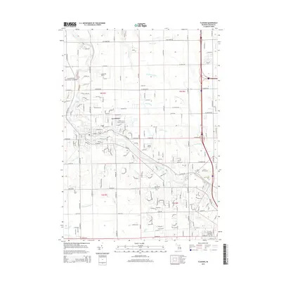
2014 Map of Flushing
USGS Topo · Published 2014About this map
The Flint River meanders through the heart of Flushing, serving as the primary geographic anchor for this portion of Genesee County. The landscape is defined by an extensive drainage network, including the Cattail Swamp Drain, Monroe Brook, and Pollock Brook, which historically supported the agricultural development of the region. Aviation history is noted by the presence of both Cedarville Airport and Dalton Airport, while a small northern section of the Manistee National Forest appears in the northwest. Genealogists will find significant value in the distribution of local burial grounds, ranging from the central Flushing Cem to outlying sites like Cronk Cem and Bendle Cem. The map illustrates a transition between suburban expansion and the rural heritage of the surrounding townships, with well-established roads like W Mt Morris Rd and Corunna Rd framing the settled areas.
Find a feature on this map
57 named features on this map. Tap any name to fly to it.
Don’t see what you’re looking for? This feature index may not catch every label — zoom into the map to look around manually.
Map Details
Editions of this 2014 Flushing Map
This is the sole edition of this map. No revisions or reprints were ever made.
Other maps of this area

1919 · Burt
USGS Topo · 1:62,500

1920 · Flint
USGS Topo · 1:62,500

1920 · Holly
USGS Topo · 1:62,500

1921 · Burt
USGS Topo · 1:62,500

1922 · Holly
USGS Topo · 1:62,500

1922 · Durand
USGS Topo · 1:62,500

1922 · Flint
USGS Topo · 1:62,500

1943 · Holly
USGS Topo · 1:62,500

1943 · Burt
USGS Topo · 1:62,500

1943 · Durand
USGS Topo · 1:62,500
Featured Places
- Flushing, MI
- Flint Charter Township, MI
- Flushing Charter Township, MI
- Mount Morris Charter Township, MI
- Clayton Charter Township, MI