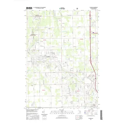
2017 Map of Flushing
USGS Topo · Published 2017About this map
The Flint River winds diagonally through this Genesee County landscape, anchoring the city of Flushing and its surrounding township. By the mid-2010s, the area reflects a transition from the wooded reaches of the Manistee National Forest in the northwest to the suburban expansion approaching from the southeast. Local aviation history is marked by the presence of Cedarville Airport and Dalton Airport, while the region's long-standing community roots are visible in an extensive network of burial grounds, including Flushing Cem, Flint Cem, and Sunset Hills Cem. A complex drainage system including Cattail Swamp Drain and Pollock Brook illustrates the managed hydrology of the Michigan terrain, while the Flushing Co Park provides a significant greenway along the river banks just west of the primary settlement.
Find a feature on this map
177 named features on this map. Tap any name to fly to it.
Don’t see what you’re looking for? This feature index may not catch every label — zoom into the map to look around manually.
Map Details
Editions of this 2017 Flushing Map
This is the sole edition of this map. No revisions or reprints were ever made.
Other maps of this area

1919 · Burt
USGS Topo · 1:62,500

1920 · Flint
USGS Topo · 1:62,500

1920 · Holly
USGS Topo · 1:62,500

1921 · Burt
USGS Topo · 1:62,500

1922 · Holly
USGS Topo · 1:62,500

1922 · Durand
USGS Topo · 1:62,500

1922 · Flint
USGS Topo · 1:62,500

1943 · Holly
USGS Topo · 1:62,500

1943 · Burt
USGS Topo · 1:62,500

1943 · Durand
USGS Topo · 1:62,500
Featured Places
- Flushing, MI
- Flint Charter Township, MI
- Flushing Charter Township, MI
- Mount Morris Charter Township, MI
- Clayton Charter Township, MI