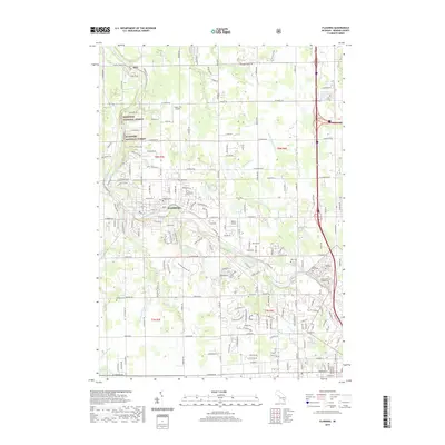
2019 Map of Flushing
USGS Topo · Published 2019About this map
The Flushing community serves as the heart of this Genesee County landscape, where the Flint River carves a winding path through a mix of suburban growth and wooded terrain. Significant land use is dedicated to memorial sites along the river's southern corridor, including the expansive New Calvary Catholic Cemetery, Sunset Hills Cemetery, and River Rest Cemetery. Small-scale aviation is represented by both Cedarville Airport and Dalton Airport, while the northern reaches of the quadrangle include segments of the Manistee National Forest. The map detail reveals a complex network of local drainage systems such as the Cattail Swamp Drain and Hartshorn Drain, illustrating the region's historical management of its low-lying river valley lands. Recreation and local history converge at Flushing County Park and smaller rural burial grounds like Flint Cemetery and Cronk Cemetery.
Find a feature on this map
181 named features on this map. Tap any name to fly to it.
Don’t see what you’re looking for? This feature index may not catch every label — zoom into the map to look around manually.
Map Details
Editions of this 2019 Flushing Map
This is the sole edition of this map. No revisions or reprints were ever made.
Other maps of this area

1919 · Burt
USGS Topo · 1:62,500

1920 · Flint
USGS Topo · 1:62,500

1920 · Holly
USGS Topo · 1:62,500

1921 · Burt
USGS Topo · 1:62,500

1922 · Holly
USGS Topo · 1:62,500

1922 · Durand
USGS Topo · 1:62,500

1922 · Flint
USGS Topo · 1:62,500

1943 · Holly
USGS Topo · 1:62,500

1943 · Burt
USGS Topo · 1:62,500

1943 · Durand
USGS Topo · 1:62,500
Featured Places
- Flushing, MI
- Flint Charter Township, MI
- Flushing Charter Township, MI
- Mount Morris Charter Township, MI
- Clayton Charter Township, MI