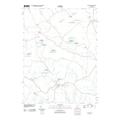
2010 Map of Flushing
USGS Topo · Published 2010About this map
Flushing stands as a central hub in this Harrison County landscape, where the legacy of regional resource extraction is clearly etched into the terrain. The presence of the Little Valley Mine and Franklin Number 65 Mine alongside numerous industrial impoundments, such as the Consolidation Coal Company Pond 0110, highlights a 21st-century topography shaped by coal operations. This industrial footprint is balanced by a dense network of local-history sites, including the Rankin Methodist Episcopal Cemetery near Cassville and the Flushing Township Cemetery. The map captures a transition between heavy industry and civic infrastructure, evidenced by the Harrison County Airport and the complex of reservoirs like Brushy Fork Reservoir Number Seven that manage the region's watersheds. This document serves as a detailed record of the geography surrounding the Flushing Post Office, documenting the intersection of rural settlements and the infrastructure of the Ohio coalfields.
Find a feature on this map
75 named features on this map. Tap any name to fly to it.
Don’t see what you’re looking for? This feature index may not catch every label — zoom into the map to look around manually.
Map Details
Editions of this 2010 Flushing Map
This is the sole edition of this map. No revisions or reprints were ever made.
Other maps of this area

1901 · Cadiz
USGS Topo · 1:62,500

1902 · Scio
USGS Topo · 1:62,500

1903 · Cadiz
USGS Topo · 1:62,500

1903 · Flushing
USGS Topo · 1:62,500

1904 · Scio
USGS Topo · 1:62,500

1905 · St. Clairsville
USGS Topo · 1:62,500

1905 · Flushing
USGS Topo · 1:62,500

1951 · Canton
USGS Topo · 1:250,000

1953 · Canton
USGS Topo · 1:250,000

1957 · Canton
USGS Topo · 1:250,000